Terraserver Satellite Photo
The Old Track Location at Concord, Vermont
Johnny Gammell told me a little about this track, and I will add more later,
when I have my note pad with me. He said it ran only in 1958. The land owner
[whose name is out in my notes] and another guy started it before the more -
successful Northeastern track, about a mile way got going. This track may have
been the impetus to build Northeastern, and Northeastern was clearly the impetus
Ken Squier needed to build T Road. So, it may have been a pretty important
little dent in a cow pasture.
[Previous notes] - Dave Morse recalls going to an old track
in the 1950's. He said it seemed like you almost went through the property of
Northeastern Speedway to get to this one, except Northeastern hadn't started yet.
Dave remembers seeing Ronnie Marvin there in a 1934 Ford coupe with a hole in
the roof, and that Marvin got in and out through the hole. As near as I can
figure, Dave it about right. As the map below will show, he has the Cross Road,
on the way to Concord, figured out. Cho Lee is the one who surmised it was the
old Concord track.
Gammell cannot recall too many men
who ran there, besides himself, possibly Harold Hannaford, and Marvin. It is
likely the eldest Ingerson [Leland] may have tried it, as well as locals like
Dwayne Remick]. That's about all I have right now.
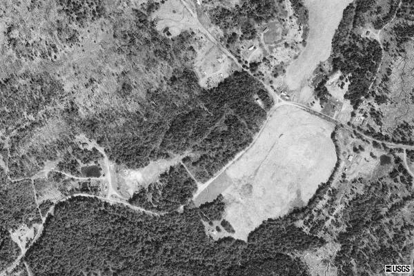
Terraserver Satellite Photo
The outline of an oval is clearly visible form this satellite shot in the 1990's. Note the road forming a right angle curve to the west of the oval [which is a pasture]. I have been there.
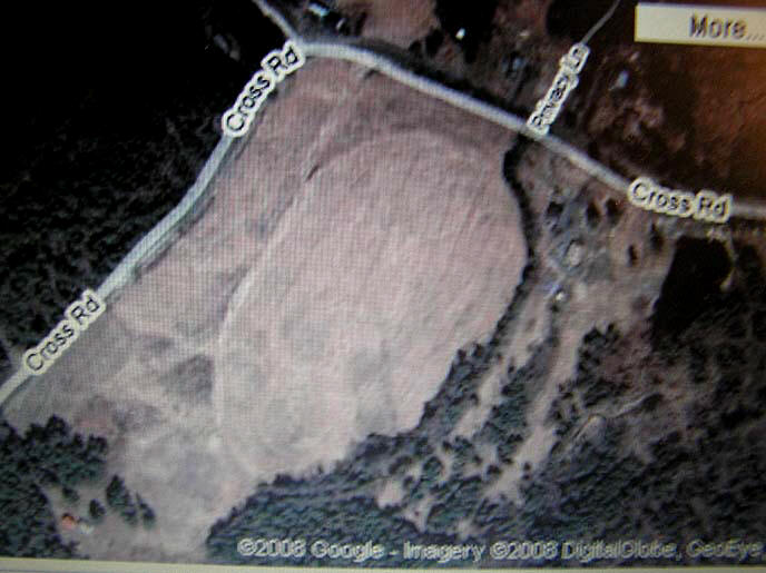
Google Earth Photo
The same site, in 2008. It surely looks like an oval to me.
 Ladabouche Photo The Concord site, from the ground. |
|
 Ladabouche Photo The Concord site, from the road. Looking up at mid turns three and four |
 Ladabouche Photo The Concord site, from the road. Across the infield [?] |
 Ladabouche Photo The Concord site, at what really looks like Turn 4. |
 Ladabouche Photo The Concord site, I dunno, what do you think ? |
![]()


USGS Map
The track location is shown in red. Northeastern is
about one mile, to the southwest.
